How to Plan a Waterfront Walk
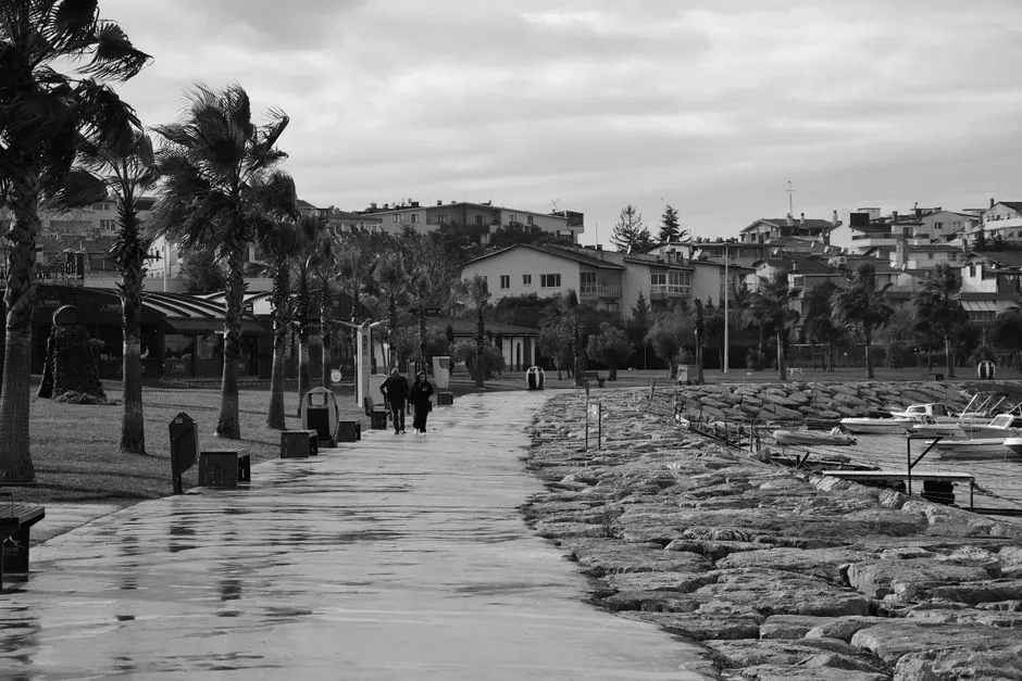
Verify every segment between the nice blue views
Plan a waterfront walk by tracing the complete public route, checking current access, surface, stairs, gates, bridges, tide or flood exposure, weather, daylight, toilets, transit, and return options through official local sources. Save a shorter alternative and a clear turnaround time. Share the route and expected return with a trusted contact when the distance, location, or group warrants it. Mark named access points that emergency responders could identify if help is needed. Do not assume a continuous shoreline means a continuous public path.
Waterfront maps are particularly talented at making industrial yards, private marinas, ferry operations, and inconvenient inlets look like a pleasant unbroken line. Zoom in before promising the group an easy loop.
Confirm public access and current conditions
Use the responsible city, park, port, transport, or land-manager page for closures, construction, events, bridge operations, seawall work, seasonal rules, and route notices. Check it shortly before departure and obey signs or staff instructions on arrival.
Identify public entrances and exits. A gate standing open does not make a private dock or service road public. Stay out of freight, boat-launch, crane, fueling, security, and crew areas. Do not climb barriers or walk along rail tracks to preserve the route.
Check current weather, wind, lightning, heat, cold, visibility, water level, tide, waves, and flood notices as relevant. Conditions can make a normally open edge unsafe before a formal closure appears.
Browse waterside routes for more segment-by-segment planning.
Read the surface and vertical access
Note pavement, boardwalk, gravel, sand, cobbles, ramps, stairs, steep grades, narrow passages, shared cycle space, and any section without a protective edge. Look for alternate accessible entrances and lifts, but verify their current operation.
Published accessibility language cannot answer every individual question. Travelers who need exact slope, crossfall, width, surface, rest, toilet, parking, or mobility-device information should contact the responsible authority where details are unavailable.
Wet timber, algae, ice, salt, spray, and sand can be slippery. Wear suitable footwear and remain behind rails. The low wall chosen as a picturesque shortcut has not read your itinerary.
Build a complete return
Measure the actual walking distance, including ramps, detours, viewpoints, bridge approaches, and the route back to transport. A linear waterfront can carry you far from the starting station while continuing to look seductively flat.
Save transit schedules and current payment information offline, but plan for a missed final service. Know the authorized taxi or ride pickup area where relevant. If relying on a ferry, check sailing status and the last practical departure directly.
Set a turnaround based on daylight, group pace, weather, and the least mobile traveler. Do not make the return contingent on crossing a beach, tidal causeway, lock gate, or movable bridge whose access window you have not verified.
Visit harbor etiquette before entering a working-waterfront section.
Carry for exposure, not distance alone
Bring water, appropriate layers, sun or rain protection, necessary medication, a charged phone, and a light when conditions warrant. There may be little shade or shelter. Keep children close and dogs leashed where permitted; check local animal rules and surface temperature.
Near deep or moving water, follow local life-jacket and activity guidance. Do not enter the water, step onto wet rocks, or descend an unapproved ladder for a photograph. In an emergency, call the appropriate local service and provide the named access point or nearest marked location.
Add stops that are genuinely available
Choose viewpoints, parks, public art, markets, museums, cafés, or ferry overlooks only after checking current hours, fees, reservations, accessibility, and photography rules. Do not invent a seafood stop from an old map pin and then ask a closed bait shop to improvise lunch.
Keep a weather-proof option nearby and allow time to sit without buying anything where public seating exists. A walk can be the main event rather than the hallway between transactions.
Our working-harbor photography guide covers safe observation from public space. The route is ready when every segment has permission, an exit, and a return—not when the line merely resembles a charming blue necklace on the phone.